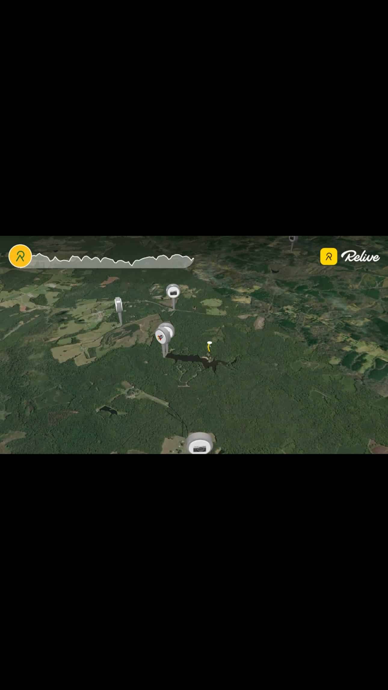
Nineteen miles of mostly smooth pavement along the Tye River does not sound dramatic, but this loop threads together three big stories: an 18th‑century mill village, a scrappy timber railroad that reinvented itself for mining, and a single flood night that cut Nelson County off from the rest of Virginia. This journey is the perfect opportunity for an ebike adventure. The average elevation hovers around 550 feet, so it rides easy—but the history sitting under your tires is anything but flat.
From Williams Grocery to Cedar Creek
We roll out from Williams Grocery on Route 655 and turn toward Cedar Creek, leaving the main road for a quieter tangle of hardwoods and fence lines. It feels like ordinary farm country, but every side hollow here is draining toward the Tye River, carving the same corridors that have moved people and water for centuries. Long before there was a Nelson County, this valley was part of the Monacan Indian Nation’s homeland—a travel route tied into the James River system.
The pavement drops gently as Cedar Creek cuts through low gaps toward the main river, past small bottoms where early farm mills once stood before bigger power and freight shifted down to the Tye. It is a good place to start thinking about how water, and the desire to harness it, shaped almost everything you are about to ride through.

Tye River Road: Timber Trains and Camille
At Tye River Road the trees open and the river finally shows up beside the shoulder—a narrow, fast stream that runs about thirty‑four miles from the Blue Ridge to its confluence with the James near Norwood. Today the Tye is a Scenic River known for paddling runs and swimming holes, but in the early 1900s its banks carried a surprisingly busy short‑line railroad.
Between 1914 and 1916, promoters for the Tye River Timber Company and Leftwich Timber Company built the Virginia Blue Ridge Railway (VBRR) from the Southern Railway junction at Tye River up along the Tye and Piney valleys. Their main target was American chestnut: a chestnut‑blight epidemic had reached Virginia by 1908, and the plan was to pull as much timber out by rail as possible before the trees rotted on the stump. When the big chestnut stands and other easy timber ran thin, the railroad pivoted to whatever kept it alive—apples in season, pulpwood and tanbark, cooperage supplies, and later heavier freight


The real game‑changer came in 1931 when Southern Mineral Products opened a plant at Piney River to process ilmenite ore into titanium dioxide; by the late 1930s, aplite quarried nearby was riding out as raw material for insulation and roofing products. Under American Cyanamid ownership after 1944, the Piney River works became the VBRR’s largest customer for several decades, shipping outbound pigment and bringing in coal, sulfur, acids, and other chemicals by rail. Today the rail is gone and the corridor downstream has been reborn as the Virginia Blue Ridge Railway Trail, but on this loop you are still paralleling the same industrial pathway.

Photo Credit: Stephen Lamanna
Courtesy of Paul Saunders – “Heartbeats of Nelson”
All of that sets up what happened in August 1969. On the night of August 19–20, the remnants of Hurricane Camille stalled over Nelson County and dropped roughly 25–30 inches of rain in eight hours, much of it onto the steep headwaters feeding the Tye and Piney Rivers. Thousands of debris flows roared down side hollows, and by midnight the modest river beside this road had turned into a moving wall of mud, timber, and houses that tore out every bridge on the Tye


Upstream in Massies Mill, entire streets vanished. Contemporary accounts and later geology work document that Massies Mill alone lost 22 residents; teenage brothers Carl and Warren Raines survived by clinging to trees while a surge killed their parents, three siblings, and several neighbor children. County‑wide, Camille destroyed more than 100 bridges and about 900 buildings, killing 124 people—around 1 percent of Nelson’s population at the time.
Even the larger railroads were not spared. Southern Railway’s double‑track Tye River bridge near Norwood lost 480 feet of its 630‑foot length, with spans washed downstream toward a low‑level highway crossing; engineers managed to rebuild a single‑track replacement and reopen the main line in less than three weeks. Smaller bridges and backroads like the ones you are riding took much longer to come back, and for days Nelson County was effectively cut off—roads, rails, telephone, and power all severed.
South Powells Island Road: Bottomland Farms and Recovery
When the loop swings onto South Powells Island Road, the valley relaxes. You are riding a slightly raised river terrace between the Tye and the bluffs—Powell family bottomland that has been in farm use since at least the late nineteenth century, anchored by riverfront farmhouses dating to around 1888. Long runs of fencing and the distance between driveways tell you these parcels stayed large, with tracts such as a 100‑plus‑acre farm at 3578 S Powells Island Road remaining intact well into the modern era.

Camille left quieter but still visible marks here. Replacement bridges on the Tye and its tributaries sit higher and straighter than their predecessors, and U.S. Army Corps and state crews dredged and straightened long stretches of the channel after the storm, which is why some bends you glimpse from the bike look over‑wide and engineered. Some of the lowest farmsteads were never rebuilt; floodplains that once held houses are now hayfields and sycamore groves, a subtle sign of how the county pulled people back from the river’s edge.
Up on the slopes beyond these bottoms, Nelson’s orchard belt took shape over the twentieth century. As rail and highway access improved, local families leaned into commercial apples and peaches, and Nelson’s high‑elevation microclimate made it a strong producer through multiple boom‑and‑bust cycles. Today apple season, farm markets, and cideries bring in visitors on the same weekends riders come for leaf color and backroad loops like this one.
Closing at Variety Mills: Before Rails and Highways

The last miles climb gently back toward Variety Mills Road, where the story steps another century and a half into the past. Tucked along Rucker’s Run, a tributary of the Tye, are the ruins of Variety Mills—an industrial cluster that predates the railroad era by more than 150 years.


Colonel William Cabell Sr. commissioned the original three‑story stone merchant mill here around 1760, using the fall of the creek to grind grain for a growing up‑river community. Over time the complex expanded to include a flour mill, sawmill, corn mill, rock‑hewn distillery, wood cooper’s shop, wool‑and‑cotton “Union factory,” tannery, shoemaker’s shop, and a store, producing such a range of goods that the place simply became known as “Variety Mills.” The surviving mill building shows that layered history: an older stone section with a later frame addition, and the north face where a turbine wheel once sat before Route 655 was re‑routed directly across the tailrace.
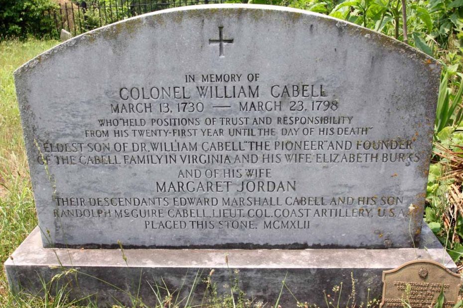
Photo Credit: Cemetery Ridge Films
The mill stopped grinding around 1918 as rail‑served mills and modern plants closer to the James made small water‑powered operations less competitive. Today, only the stone shell and an early‑20th‑century store building remain, but finishing a ride here ties the loop together: you start at a country store, drop into a river valley that carried timber trains and titanium ore, pass through flood‑reshaped farmland, and end at the remains of a colonial‑era industrial village.
Ride Notes and Takeaways
For riders, this is a low‑stress loop with big context. You are mostly on narrow paved roads with light local traffic, following Cedar Creek down to the Tye, tracing the old Virginia Blue Ridge Railway corridor in spirit if not in sight, then cruising the flats of South Powells Island before climbing gently back to Variety Mills. The numbers are modest—about 19 miles, average elevation around 550 feet, and only rolling climbs—but nearly every mile carries some combination of mill history, short‑line railroading, orchard country, and Camille’s legacy.
If you bring anything away from this loop, let it be this: what looks like a calm backroad ride is layered ground. Mills that have not turned since 1918, rails pulled up in 1980, and a 1969 storm that still dictates where bridges and houses sit all share the same narrow valley. On an eBike, you have the time and headroom to notice i


Sources:
- Variety Mills – Cabell Family Society history
https://cabell.com/variety-mills/ - Historic resources survey (Variety Mills, Norwood/Wingina, roads, structures)
https://www.dhr.virginia.gov/pdf_files/SpecialCollections/NE-009_Historic_Resources_Identification_and_Assessment_Nelson_County_ …
https://www.nelsoncounty-va.gov/wp-content/uploads/2023/07/NorwoodWingina_Report_063014.pdf - Virginia Blue Ridge Railway overview
http://www.virginiaplaces.org/rail/vabr.html - Virginia Blue Ridge Railway Trail history
https://www.traillink.com/trail-history/virginia-blue-ridge-railway-trail/ - Whippany Railway Museum – Virginia Blue Ridge Railway history series
https://whippanyrailwaymuseum.net/virginia-blue-ridge-railway/ - Hurricane Camille in Nelson County – Nelson County Historical Society
https://nelsonhistorical.org/hurricane-camille - Camille background and county documents (PDF)
https://www.nelsoncounty-va.gov/wp-content/uploads/2023/06/Camille-Outside-8-12-11.pdf - Hurricane Camille statewide overview
https://encyclopediavirginia.org/entries/hurricane-camille-august-1969/ - Massies Mill and Camille debris‑flow analysis
https://chuckbaileyrocks.pages.wm.edu/2025/08/20/massies-mill-and-the-hurricane-camille-flood/ - Tye River history and context
https://www.rockfishvalley.org/tye-river-study/history/ - Nelson museums and heritage (Oakland Museum, Camille exhibits)
https://nelsoncounty.com/museums-heritage/ - Virginia Blue Ridge Railway Trail – current recreation info
https://nelsoncounty.com/explore/virginia-blue-ridge-railway-trail/
Discover more from The FatTire Nomad
Subscribe to get the latest posts sent to your email.